Orbital Edge Imaging
Proof-of-concept web application for a (fictional) startup that enables users to search the company's API using a specified Area of Interest.
React
Mantine
TypeScript
Next.js
Leaflet
Turf
API
24/08/2023
Abstract
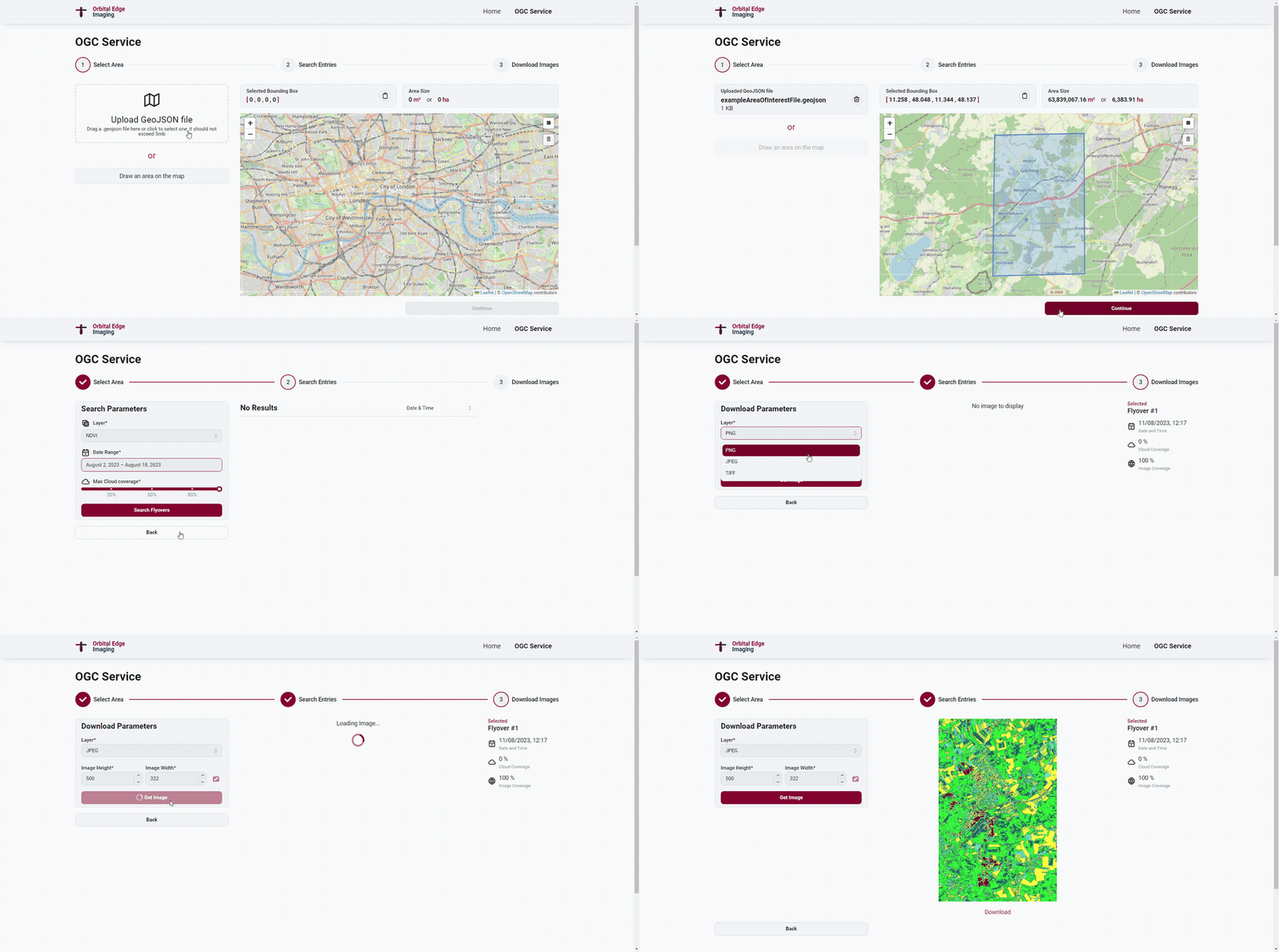
This is a proof-of-concept web application for a (fictional) startup called "Orbital Edge Imaging" that enables users to search the company's API using a specified Area of Interest.
Features
- Upload a GeoJSON file or draw an Area of Interest on the map
- Get a list of satellite flyovers by date, cloud cover, and image cover
- Get specific layers of the map (TRUE_COLOR, NDVI, VEGETATION, etc.)
- Download the image in different formats (jpg, png, tiff) and sizes
Technologies
- React with TypeScript
- Mantine UI (component library)
- Valtio (state management)
- Next.js (server-side rendering)
- Leaflet (map library)
- React-Leaflet (React wrapper)
- React-Leaflet-Draw (drawing on the map)
- Turf.js (geospatial analysis)
- Cypress (end-to-end testing)
GIFs

